
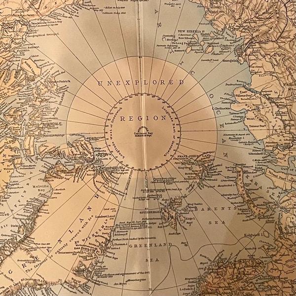
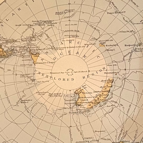
Last night at a friend's house we had a look at an old atlas we found many years ago. It's The Times Atlas, first edition from 1895, which I knew includes a few very cool unexplored regions.
What I didn't spot until last night was the inclusion of Wales on the map of South Africa.
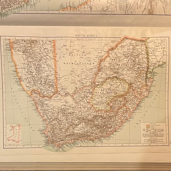
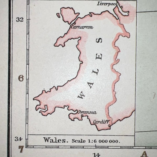
I think this must be an early example of Wales being used as a unit of measurement for grasping the scale of something. I assume it was included for context as there was likely much "interest" in the region (i.e., war).